Flooding is in the news again. However, this time it is flood prevention in the spotlight: advocation of tree planting to mitigate risk. The national conversation has come about as a result of the release of a study, commissioned by the Environment Agency and led by researchers from the Universities of Southampton and Birmingham. Put simply, the study has suggested that tree planting can play a part in future flood prevention strategies. The headline from the media is that ‘planting trees in river catchments can reduce the height of flooding in towns by up to 20%’.

However, I wanted to go beyond the headlines and see what the paper really said. The research is available online in the journal Earth Surface Processes and Landforms although it has yet to be officially published and has not been copy-edited or proofread (reference: doi:10.1002/esp.3919). It is all very well people like me blogging away about flooding mitigation and slowing the flow etc but in reality it is the science we should be listening to. If you would like to read the full paper it is available on wiley.com (reference at the bottom of this article).
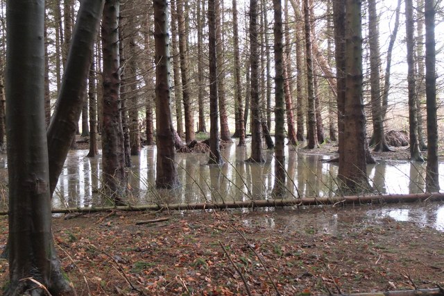
In the research project Simon Dixon and colleagues studied 98km² of the Lymington river catchment in the New Forest, upstream of the town of Brockenhurst. They used reduced complexity hydrological modeling to analyse the effects of land use and changes in channel flows on flooding within the wider catchment. Critically they found that tree planting within catchments can mitigate flood risk through interception, infiltration and attenuation but in order for there to be appreciable impacts on the entire catchment restoration needs to take place on a large scale. According to their model, planting trees on the floodplain and increasing logjams across 10-15% of the total river length reduced peak height of potential flooding by 6% once trees were at least 25 years old. However, if trees were planted within 20-40% of the river catchment the effects could be more like a reduction in height of up to 19-20%.
Interestingly, a key finding was that whilst logjams may have positive impacts locally (within 1-5 km), when expanded to a whole catchment scale the impacts are often minimal, suggesting that ‘slowing the flow’ may need to be reassessed. The reality with logjams is that they direct water on to floodplains and when the floodplain is pasture or arable land the water will still flow over the surface quickly. Logjams should be used in areas of the river where there is complex bankside vegetation so slowing of the flow can be beneficially targeted. The researchers stressed that whilst the measure acts as positively in some areas, in others it has no or little positive impact at all.
Something that isn’t emphasised enough in the press publicity is that Dixon et al ultimately caution against the wholesale uptake of the restoration measures they explore in the paper and repeat the need for more careful analysis of the spatial and temporal implications of management (Dixon et al, upcoming 2016). According to the research, management of individual catchments should be governed on a case by case basis and a multiplicity of different options assessed in generating a comprehensive water catchment management strategy.

Yesterday I visited South Cerney in Gloucestershire with a group of students to learn about water flow mapping with FWAG‘s Jenny Phelps. Something I took away from this visit is the absolute necessity in knowing the land itself, understanding where and how problems originate and looking for solutions to local issues through understanding the situation both locally and on a catchment scale. Dixon et al’s approach needs to be coupled with a local approach to land management planning which involves local people and landowners. Only then will projects which call for such drastic landscape change be able to get off the ground and receive the support of the people who are immediately affected.
Similarly to my recent post on rewilding, we need to be careful with planning flooding mitigation efforts involving drastic landscape change that the social and economic implications are not forgotten. River restoration has the capacity to bring people together through voluntary involvement such as tree planting. However, it also has the capacity to generate anger in communities if they are not involved in the process, especially amongst the farming and landowning community. We need to recognise that local landscapes are important for local people and existing land uses may have additional value that must not be forgotten when focusing on land-use change as a result of preventing flooding. This said, Dixon et al’s paper should be welcomed as one piece of evidence, amongst a growing amount, which suggests that natural mitigation efforts through landscape development can be used to reduce the risk of flooding in areas at risk of flooding downstream.
References
Dixon, S.J., D.A. Sear, N.A. Odoni, T.Sykes and S.N. Lane (upcoming 2016), ‘The Effects of River Restoration on catchment scale flood risk and flood hydrology’ in Earth Surface Processes and Landforms, doi:10.1002/esp.3919.

Hi, thanks for the interest in the paper. Whilst it’s always nice to get the splashy press coverage, it’s also great to see people looking into the subject in more depth than the papers etc can cover and picking out some of the more nuanced (and arguably more important) messages from the study.
Thanks again
Simon Dixon
No problem. Thanks for the comment and for providing the study in the first place! You know far better than I the complexities of the issues involved and the paths we need to tread in moving forward. It is the nuances in the paper that interested me most. As you say, it is good that the papers pick up info such as the conclusions in your study although due to the nature of journalism it often means underlying messages and conclusions are neglected.